Directions
Site specific directions
 Here are directions to some of the many sites where we work.
Burgner Acres:
Take Loxa Road (CR 1100E) to the stop sign at CR 1000N, turn east, go 0.3 mile to CR 1130E, turn south and go to the dead end.
Baber Woods:
From Westfield take the Clarksville Road 4 miles to Cleone Road, turn left and go 2 1/2 miles to the woods on the right.
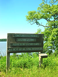
Coneflower Hill Prairie:
To get to Coneflower Hill Prairie, take Ill. Rt.121 west from Mattoon to Coles Station, turn left on the Findlay Road and go about 5 miles to the Coles-Moultrie substation on the right. Turn right and go 2 miles to the “T,” then left one-half mile to the brown pole barn. There is a parking lot there and the hill prairie itself is opposite the parking lot on the other side of the road.
Douglas-Hart Nature Center and the Lincoln Prairie Grass Bike Trail Prairie:
Douglas-Hart Nature Center is located at the corner of DeWitt Ave. and Lerna Road (CR 13) at the east edge of Mattoon.
Most workdays held at the Lincoln Prairie Grass Bike Trail Prairie will start off by meeting at the Douglas Hart Nature Center. To get to the bike trail prairie just turn off of the Lerna Road right onto road 800N, and proceed until the bike trail is cut in two by the road. Just after that crossing is a farm lane on the left hand side of the road. That marks the beginning of the bike trail prairie where we manage. From there the prairie proceeds on to the east toward Charleston until you come to the next farm lane.
Fox Ridge State Park:
Fox Ridge State Park is 8 miles south of Charleston on Ill. Rt. 130.
Hanley Prairie:
Take Hwy. 130 south of Charleston to Coles County Road 300N. Turn west and continue around several "S" curves heading south about 1.7 miles to Hunter Parking Lot 4 just past the end of the maintained road. Hanley Prairie is southeast of the parking lot and east of the horseback riding trail. Google Maps coordinates: 39.411043, -88.150034
James Nance Woods:
Take 6th Street west from the four-way stop in Neoga, go 2.2 miles past the city limits to Shelby County Road 3425E, turn right and go 0.9 mile past two "S" curves to the woods on the right.
Lafferty Nature Center:
Take Reynolds Drive three blocks south from IL Route 16 in Charleston to Carl Sandburg School. Park in back of the school.
Lakeview Park:
Follow the directions for Waterworks Hill Prairie but continue to the end of McKinley Avenue.
Neoga Prairie Remnant:
Take IL Route 45 south about one mile from the four-way stop in Neoga and turn right at the cemetery sign. The prairie is just over the tracks.
Rocky Branch Nature Preserve:
From the cafe at the top of the hill in Clarksville, take 1150 Street north about 1/2 mile to 2100 Road, turn right and go about 1 1/2 miles east to 1300 Street, turn left and go about 1/4 mile to the small parking area on the left.
Walnut Point:
Walnut Point State Park is 3 miles north of Oakland.
Warbler Woods/Embarras Ridges:
Take Route 130 south from Charleston to Daileyville Road (CR1470N). Warbler Woods is 1/2 mile down the road to the gate at the second left turn. Embarras Ridges is another 1/2 mile down the road to a parking area on the right.
Waterworks Hill Prairie:
Take IL Route 130 six blocks south from the junction with IL Route 16 in Charleston. Turn east on McKinley Avenue and park at the corner of McKinley Avenue and Stoner Drive West. The hill prairie is on the north side of McKinley Ave., down the steep slope and across the gully.
Woodyard Memorial Conservation Area:
Take IL Route 130 2 miles south from the junction with IL Route 16 in Charleston. The entrance to the site is on the left.